This page is for pilots, air traffic controllers, and anyone else who is involved in any flight operations in the vicinity of Hope BC (CYHE). Read on to learn about our gliding activity to help each other to stay safe.
We’ve made posters to help highlight some aspects of our operations. A printable version of this poster is available here.
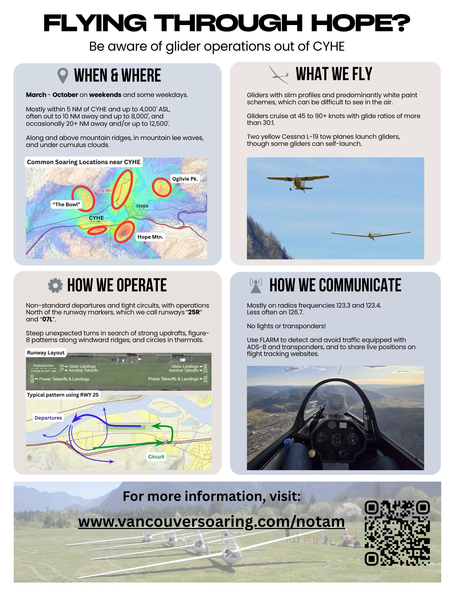
When We Fly
Spring to Fall
Expect glider operations from mid-March to mid-October on weekends, holidays, and the occasional weekday when soaring conditions are good. We also run a few week-long courses and soaring camps in the late spring and summer. Operations are during daylight hours, and usually start around 11am and may continue until sunset.
Where We Operate
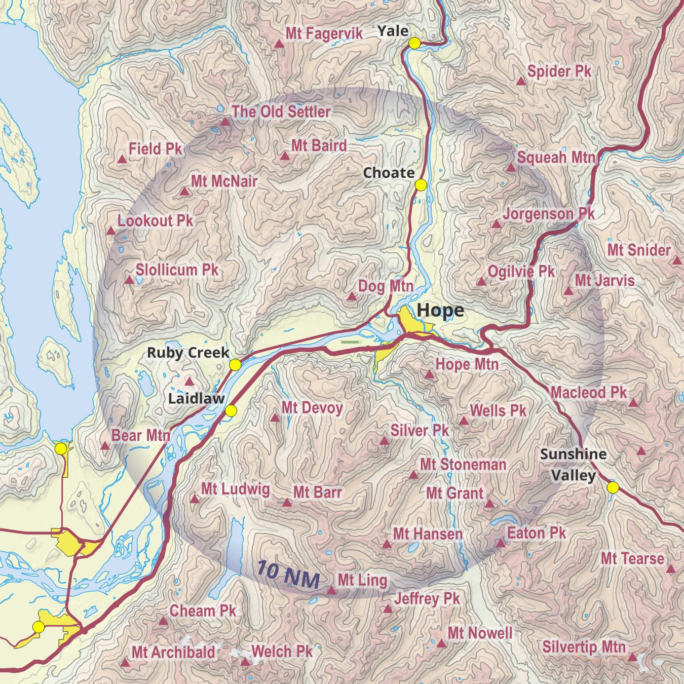
Mostly within 5 NM of CYHE and up to 4,000 ft
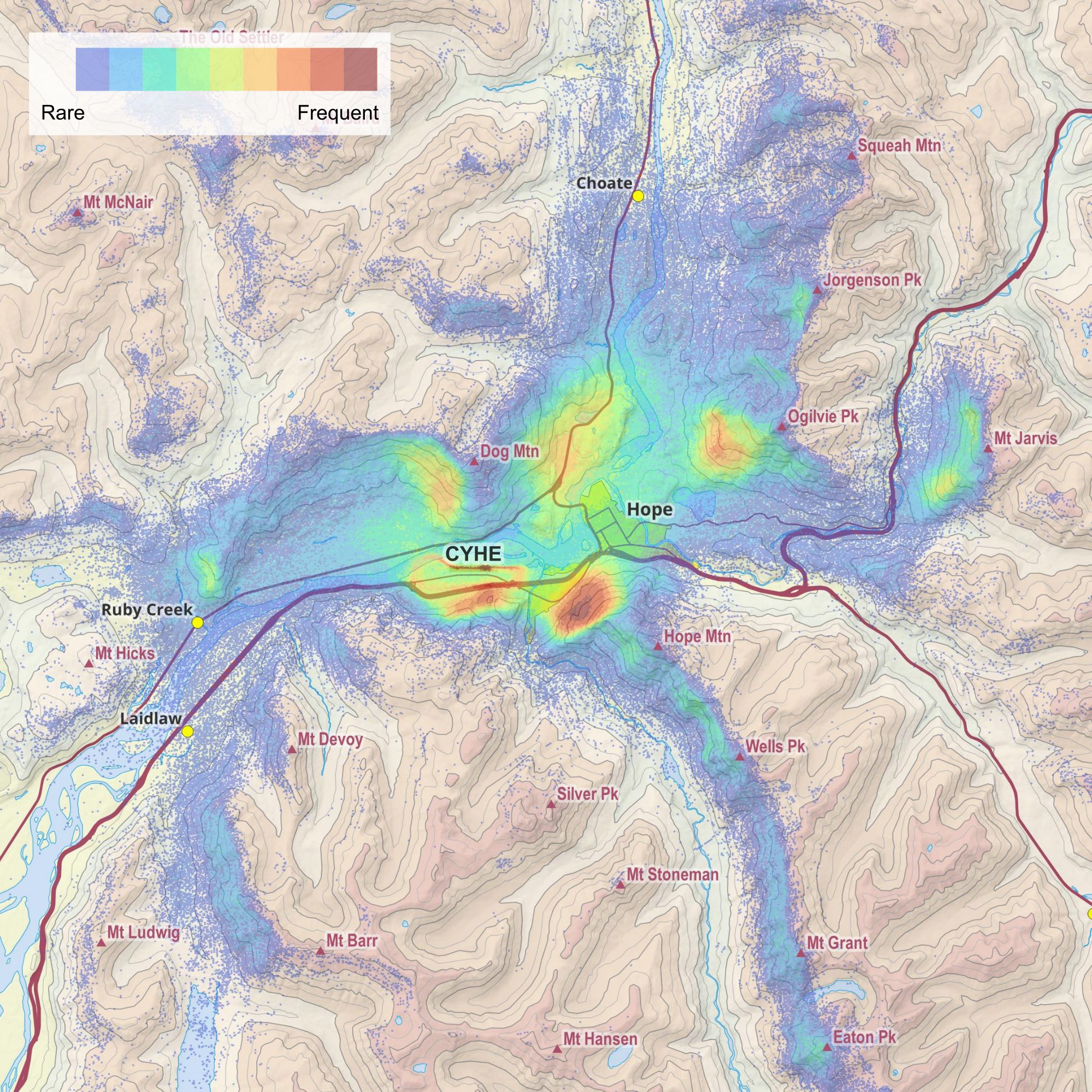
The majority of our flying takes place within 5 NM of CYHE and up to 4,000 ft ASL. These include basic training flights, familiarization flights, and flights by glider pilots who we have not yet been approved to fly cross-country. On a typical west wind day, gliders commonly fly along the northwest face of Hope Mountain, in and along “The Bowl” to the west of Dog Mountain, and along the south and west aspects around Ogilvie Peak.
Up to 12,500 ft
Gliders can climb as high as the atmospheric conditions allow, but around Hope we are generally limited by Class B airspace to 12,500 ft ASL. It takes special conditions to reach these altitudes, which only happen several days each year. Climbs up to 8,000 ft ASL are typical on good soaring days.
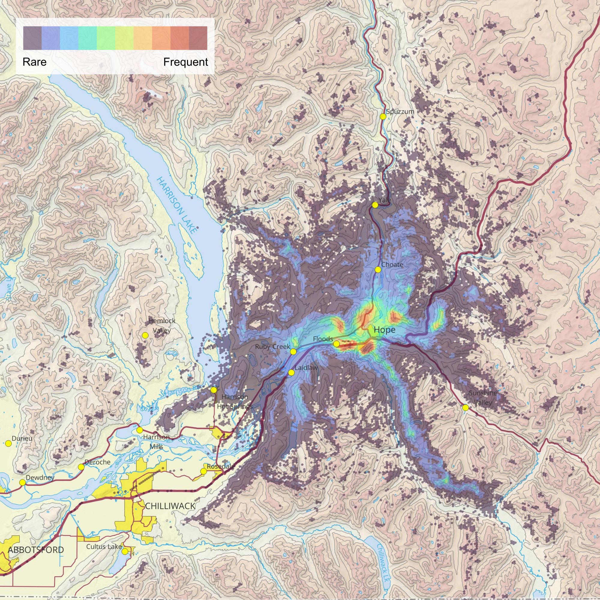
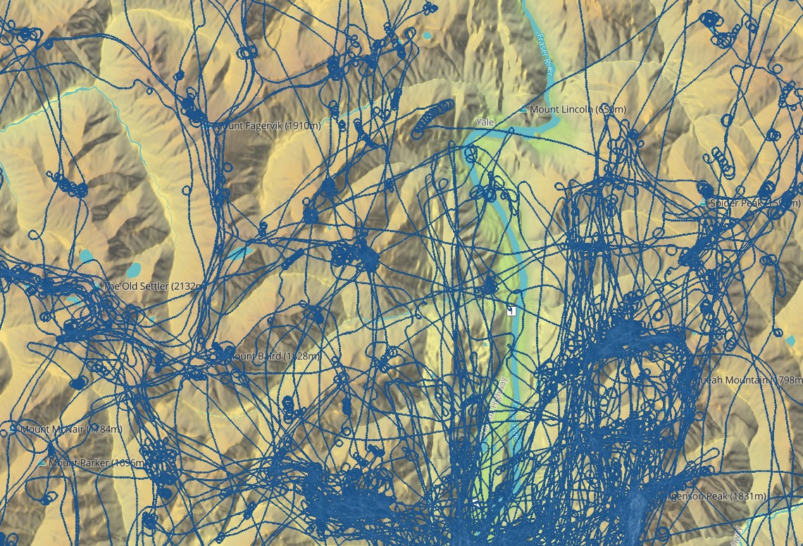
Far From Hope
Gliders can fly hundreds of miles from CYHE. The furthest flight on record is Hope – Lillooet – Shuswap Lake – Hope, a triangular distance of 283 NM (525 km) completed in 7 hours. Most cross country flights remain within 20 NM of Hope. Pilots don’t usually fly any further west than Harrison Lake and the mountains bordering the Fraser Valley. We stay out of Class C airspace.
Along mountain slopes / ridges
When the wind is blowing at 10 kts or more, expect to find gliders flying along terrain that is likely to push air upwards, such as slopes that face directly into the wind. Gliders typically fly within 1,000 ft from these slopes.
In thermals
Thermals can be thought of as columns or bubbles of warm air rising from the ground. Warm spots on the ground, such as the town of Hope and rocky south-facing slopes on a sunny day, are hot spots for thermal formation. Thermals tend to rise up mountain sides and converge above mountain tops. Thermals may develop into cumulus clouds at higher altitude.
In mountain waves
Mountains can create standing waves in the atmosphere downwind, similar to how a rock at the bottom of a stream produces a standing wave along the water’s surface downstream. A wind speed of 15 knots or greater at the mountain tops is necessary to set up these oscillations. Waves can be marked by lenticular clouds or a gap / hole in an otherwise overcast layer. Gliders flying in these mountain / lee waves may climb many thousands of feet above the mountain tops. One common location for mountain waves is west of Hope town between the Fraser River and Dog Mountain.
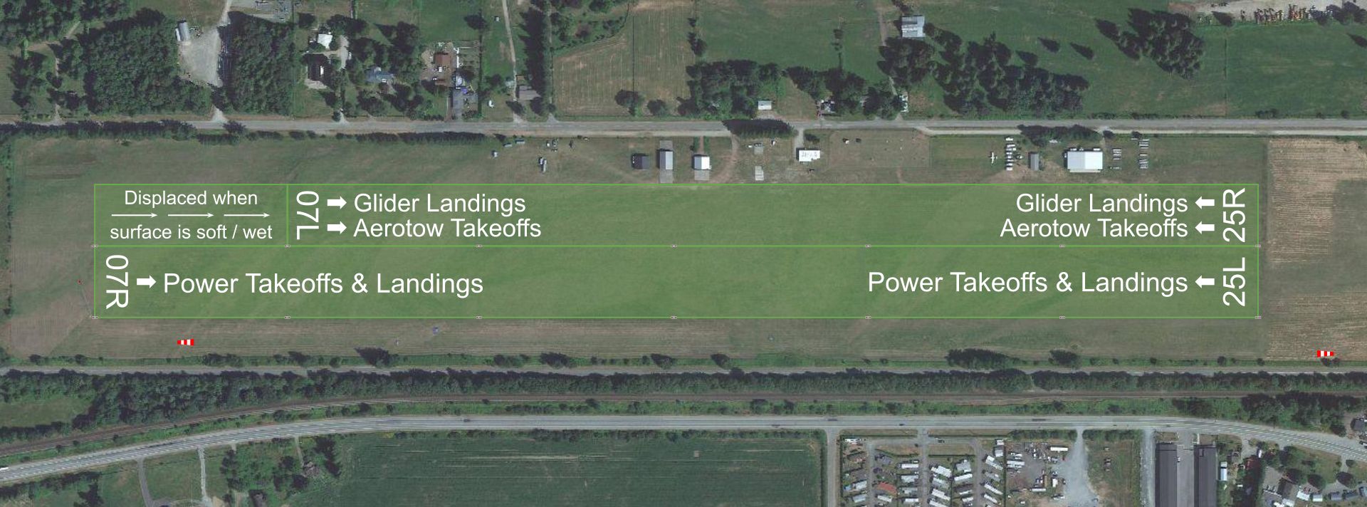
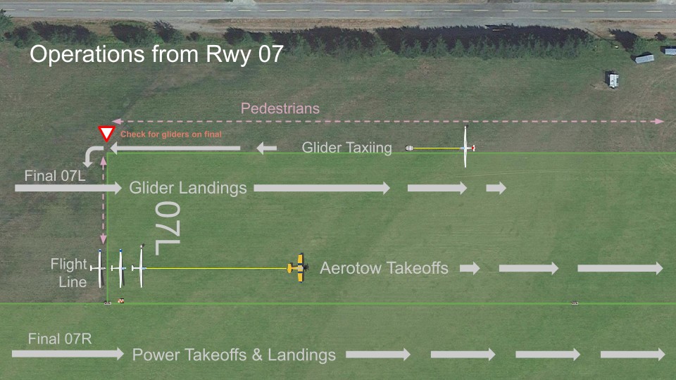
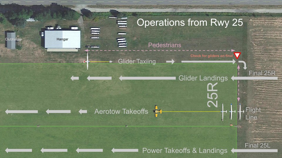
On the North side of Runway 07/25
Gliders stage, take-off, and land on the north of the marked runway at CYHE, which we call “Runway 25R” or “07L”. Take-offs are just north of the power runway, and landings north of that. Pedestrians are asked to stay as far north as practical, and cross directly across from the flight line after checking for gliders (which are silent) on final approach. We ask power traffic to be mindful of our operating area when taxiing and stopping.
How We Communicate
Radio frequencies 123.3 and 123.4
We use the ATF 123.3 MHz in the ATF area (5 NM radius from CYHE up to 3,100 ft ASL), with ground crews also monitoring 123.3.
Glider pilots typically switch to 123.4 (allocated for soaring activities) beyond the ATF area for air-to-air communications such as position and condition reports. We encourage power traffic in the area to provide a position report on 123.4.
Glider pilots are expected to make position reports on 126.7 in areas frequented by power traffic.
NOTAMs for flights above 8,000 ft
We publish a NOTAM advising of gliding activity from Surface to 12,500 ft ASL within 10 NM of CYHE on days when gliders fly (or are expected to fly) above 8,000 ft ASL. We also notify Nav Canada by telephone upon requesting the NOTAM to inform the controllers directing IFR traffic in the area. The controllers will try to keep IFC traffic safely above gliders in the area.
Calls to Vancouver Centre above 8,000 ft
We ask our pilots to make VFR position reports to Vancouver Center every 15 minutes when above 8,000 ft ASL and beyond the NOTAM area described above in order to help deconflict from IFR traffic.
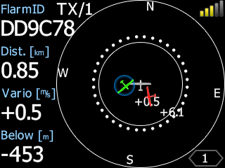
Collision avoidance with FLARM
Our gliders and tow planes are equipped with PowerFLARM. So-called “FLARM” (Flight Alarm) is a low-powered detect-and-avoid technology that broadcasts GPS position and barometric altitude and receives position and altitude from other traffic equipped with FLARM, ADS-B, and Mode C transponders. Radar-style displays in the cockpit depict nearby traffic and will sound alerts with increasing severity as the time to potential collision falls below about 20 seconds. Nearby traffic may be displayed on connected flight computers with map displays. We also share FLARM information with online flight tracking websites to live track our aircraft near CYHE.
FLARM has several limitations including:
- Signals are not visible to other traffic advisory/collision avoidance systems such as TCAS.
- Bearings to Mode C transponders are not provided.
- Resolution advisories are not provided.
- “Blind spots” exist depending on the antenna installation (typically below and/or behind).

Live online flight tracking
Glider and tow plane positions may be viewed on multiple online flight tracking websites with a few seconds latency. A station at CYHE receives signals from the FLARM units on our aircraft and feeds websites such as PureTrack and FlightRadar24.
What We Fly
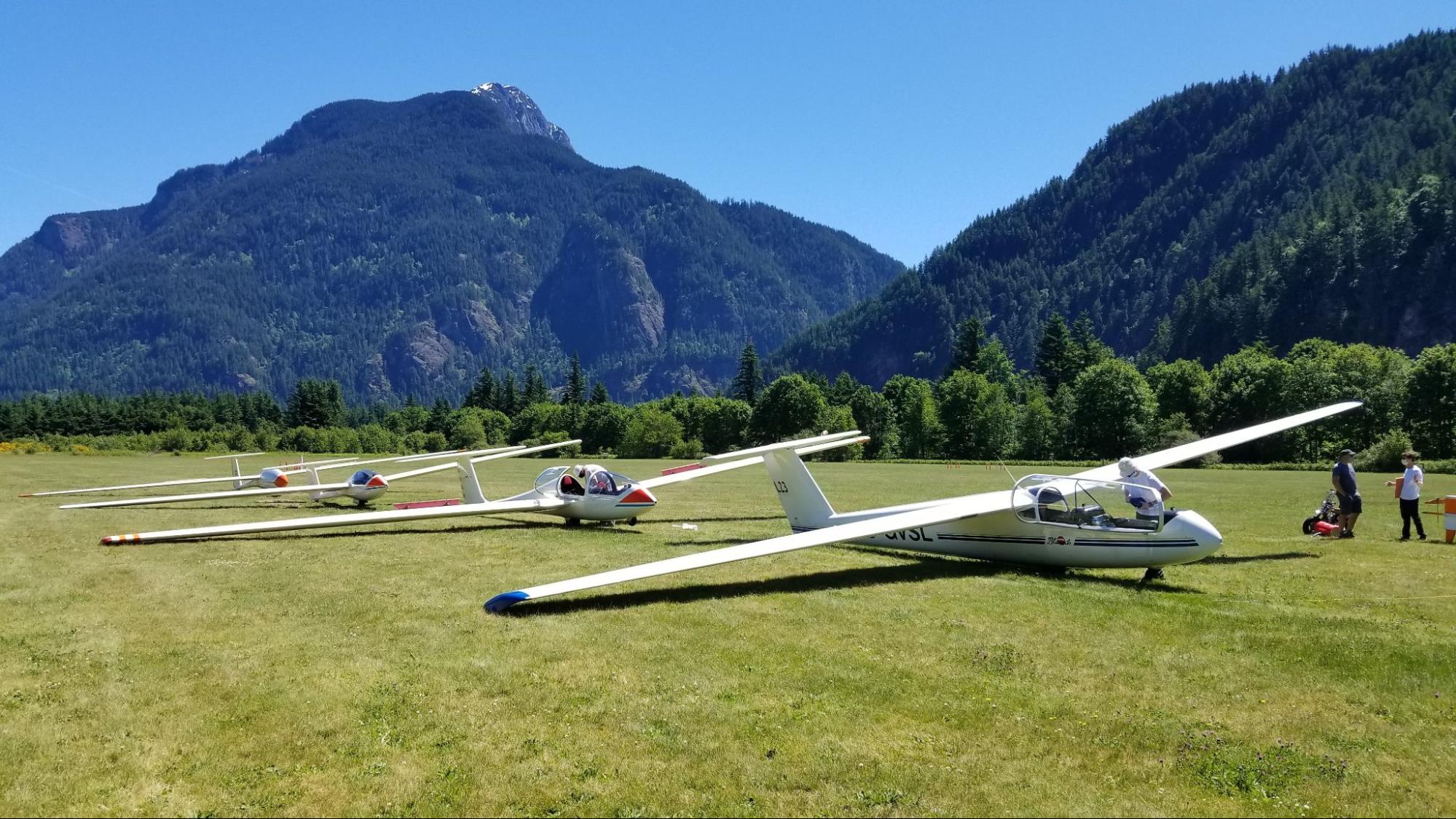
Glider design
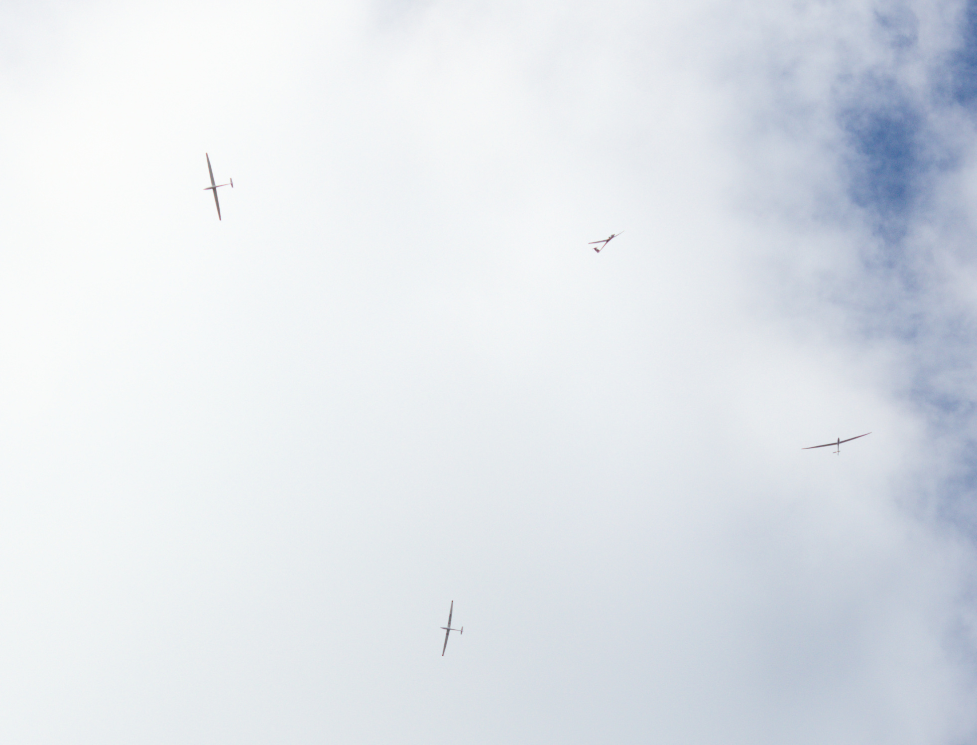
Our club and members own & operate nearly 20 gliders. Also known as “sailplanes”, these aircraft have wingspans of 15 – 20 metres (49 – 66 ft), glide ratios between 30:1 and 45:1 at speeds of 45 – 65 kts, and may cruise at speeds in excess of 90 kts. Their slim profiles and predominantly white paint schemes can make gliders difficult to see in the air.
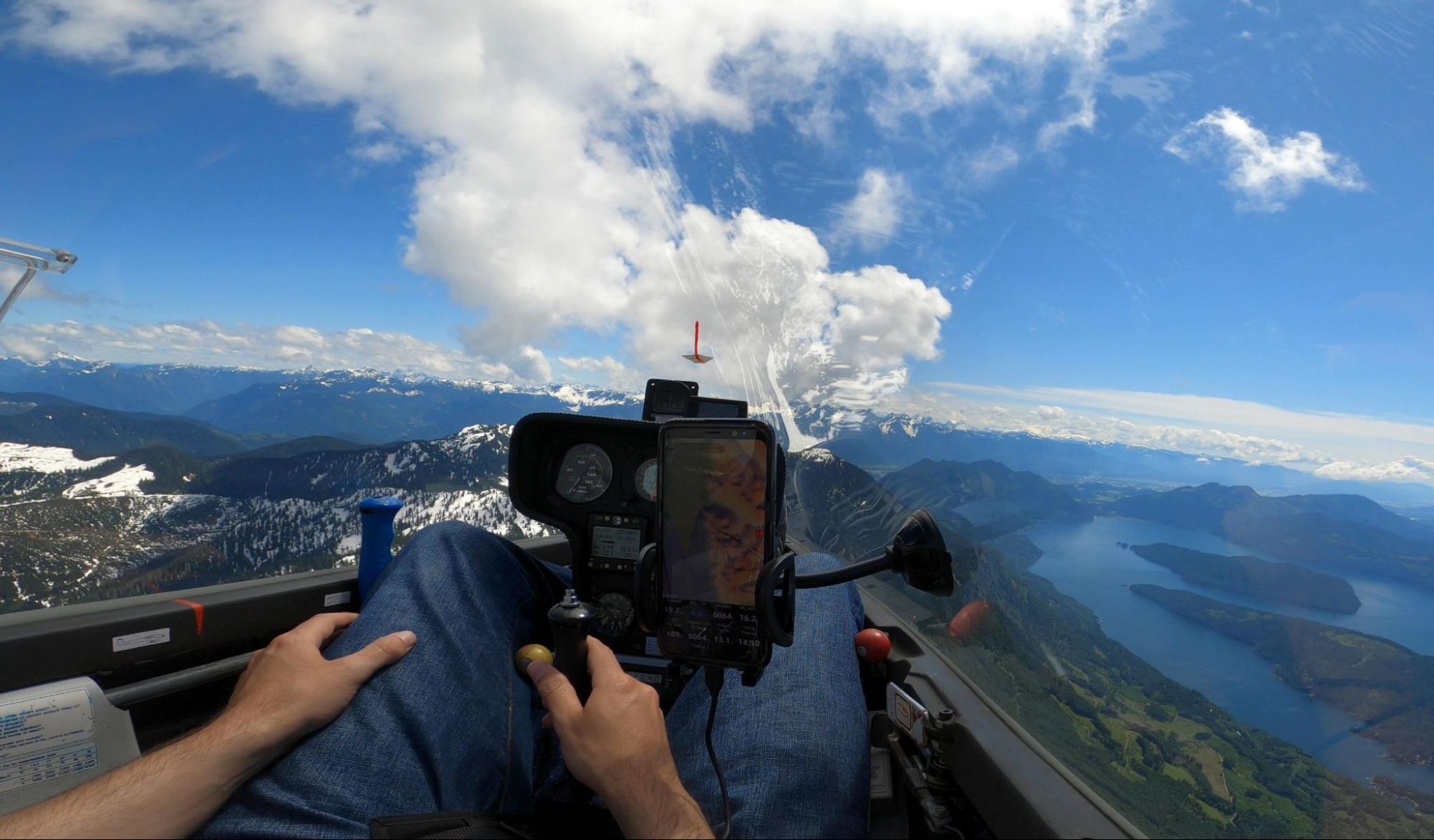
Glider cockpits
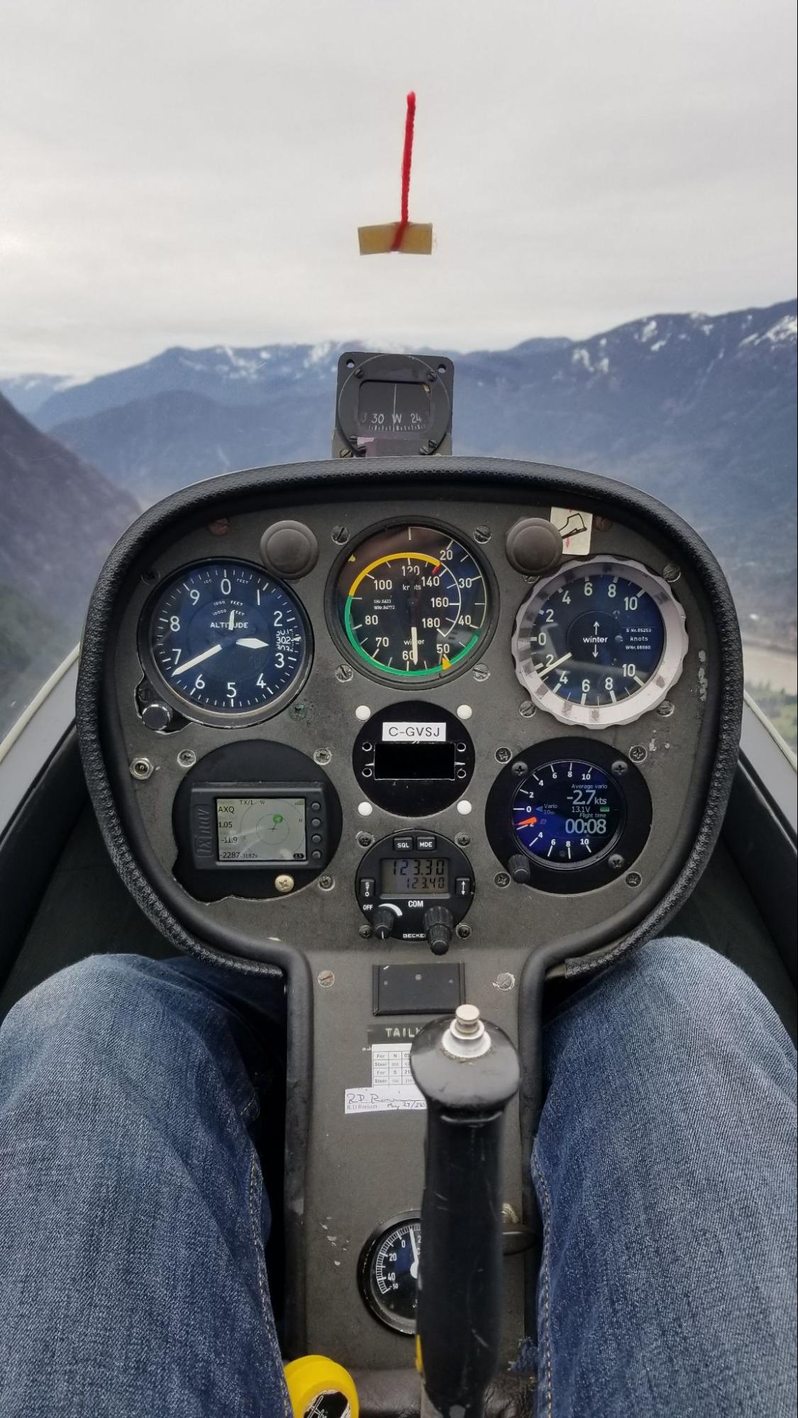
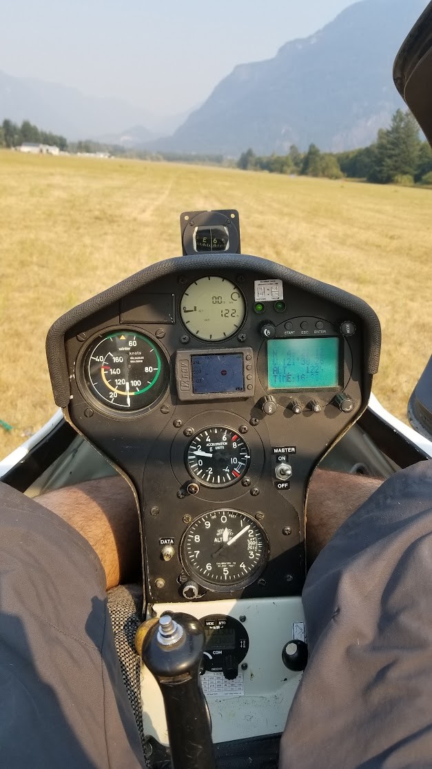
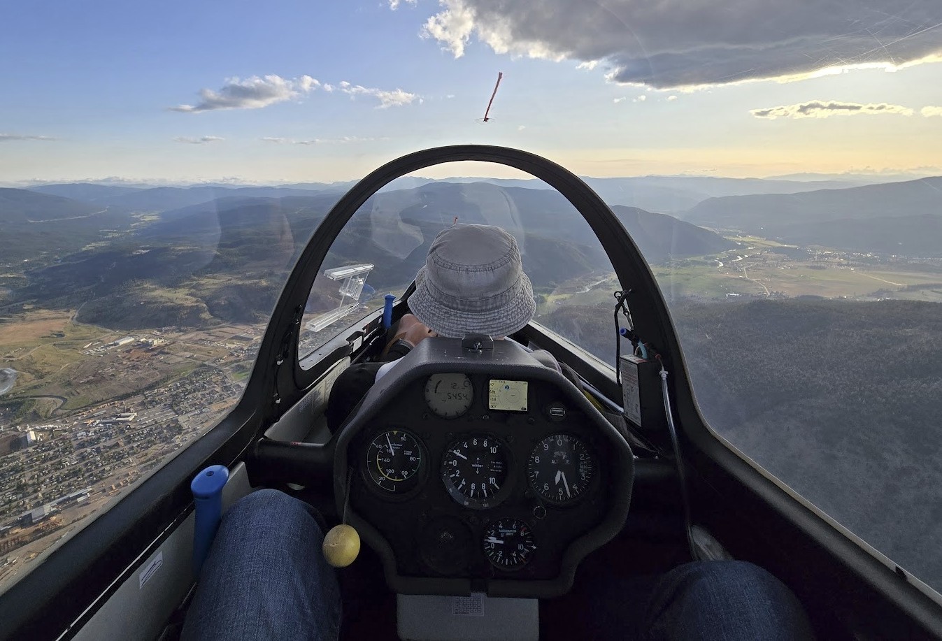
Glass canopies provide largely unobstructed views from the cockpit, except from the rear seat of two-seat gliders, which is where instructors usually sit. Instruments include an air speed indicator, altimeter, vertical speed indicator / variometer, yaw string, and compass. Pilots flying cross-country often use a flight computer to assist with navigation, which may include a moving map display.
Radios but no lights or transponders
Our gliders are equipped with air-band radios, including a microphone for each seat. Most of our radios are only capable of monitoring a single frequency at a time. Gliders are not typically equipped with strobe lights, navigation lights, or transponders.
Tow planes
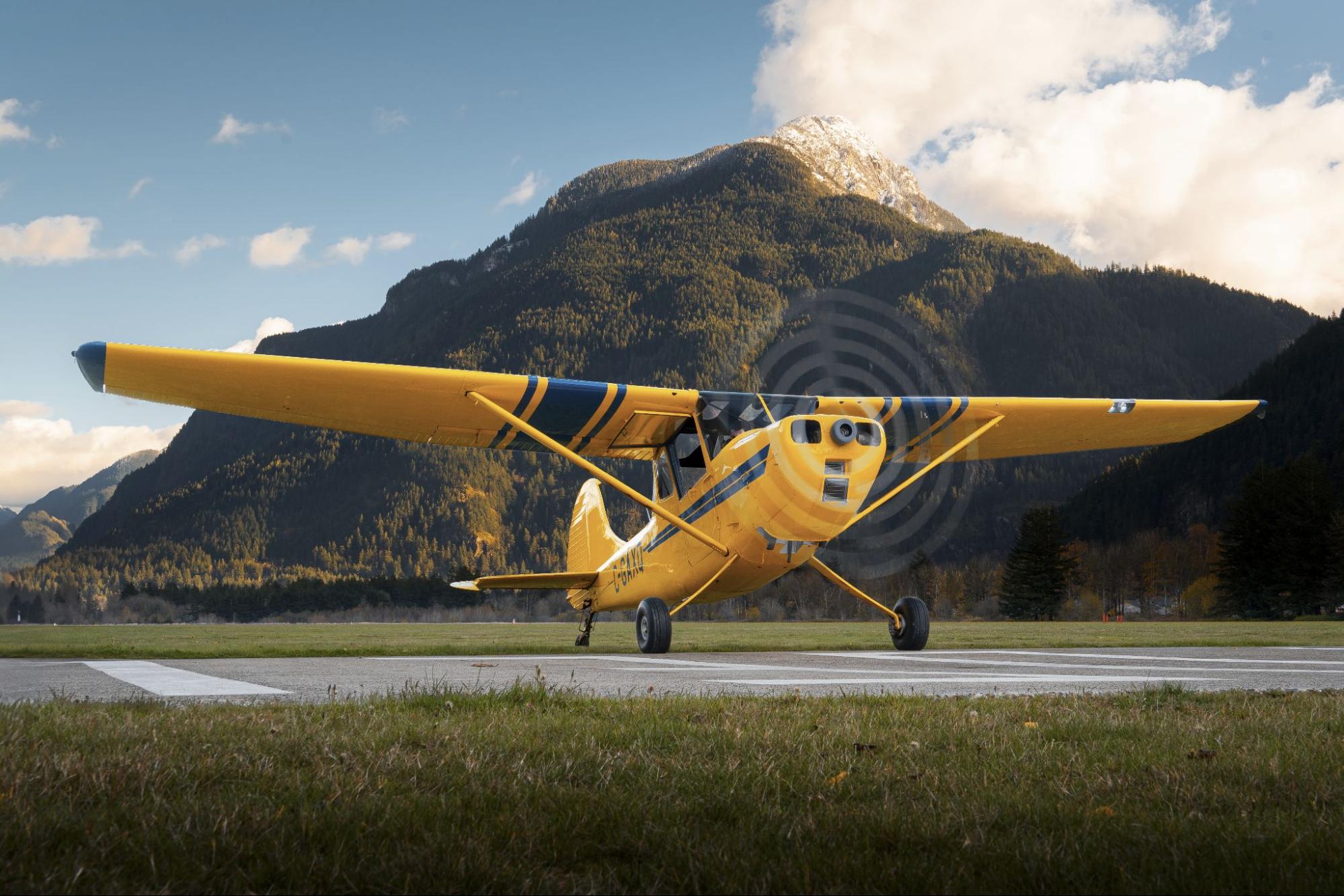
We operate two yellow Cessna L-19 tow planes to launch gliders: C-FAUJ and C-GAXQ. Only one of these tail-draggers is usually operational on any given day. A tow rope 200 feet-long hangs from the tail of the tow planes with metal rings on the end. If you see a tow plane flying around CYHE, check for gliders on tow behind it and also in free flight. Only one of our tow planes is equipped with a transponder.
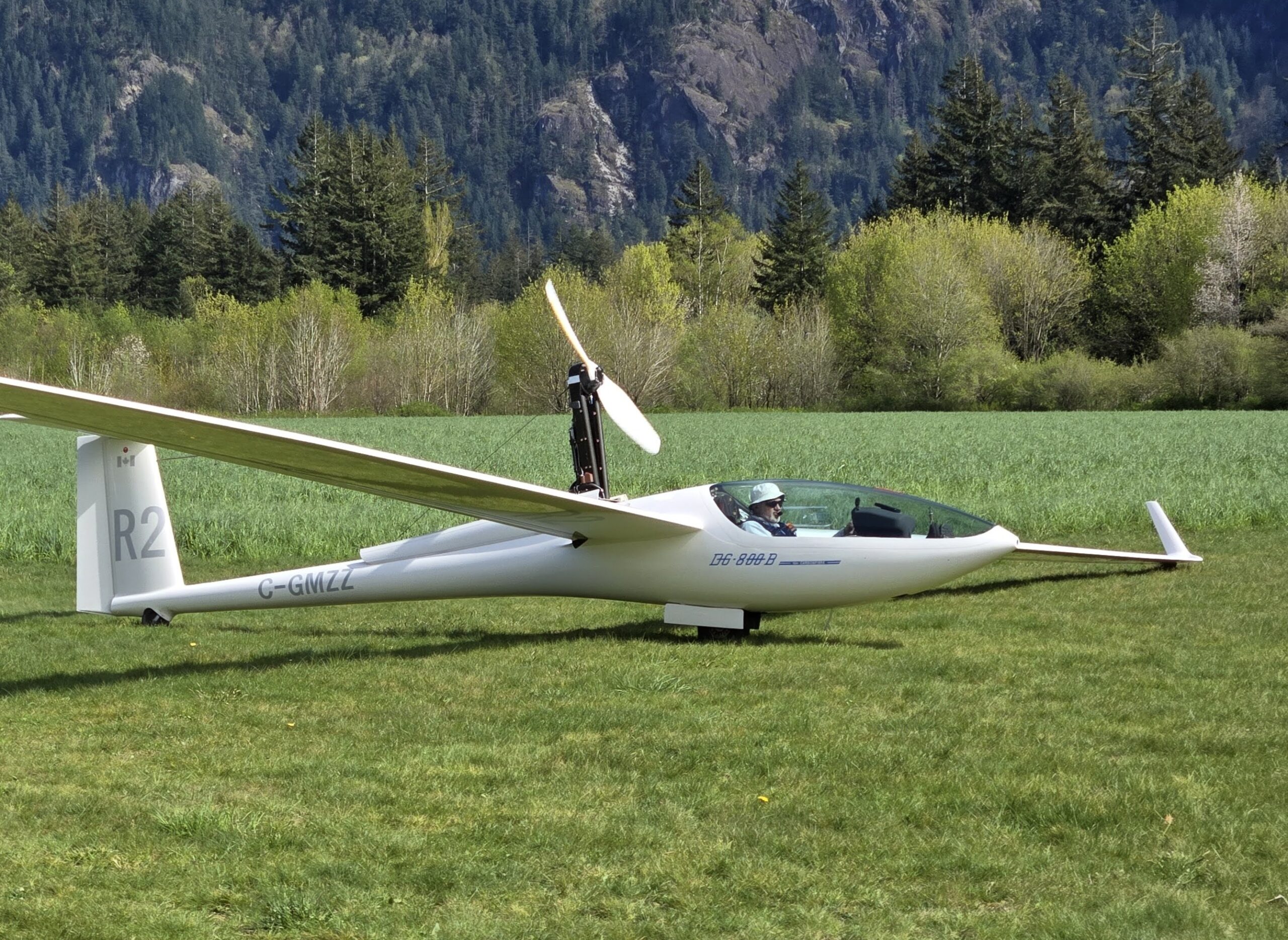
Motor gliders can self-launch
A small number of motor gliders operate from Hope. Motor gliders start up next to the power runway before taxiing onto it for immediate takeoff. Some motor gliders have an engine and propeller that the pilot extends from the fuselage behind the cockpit for takeoff, and then retracts after reaching their desired location and altitude.
How We Operate
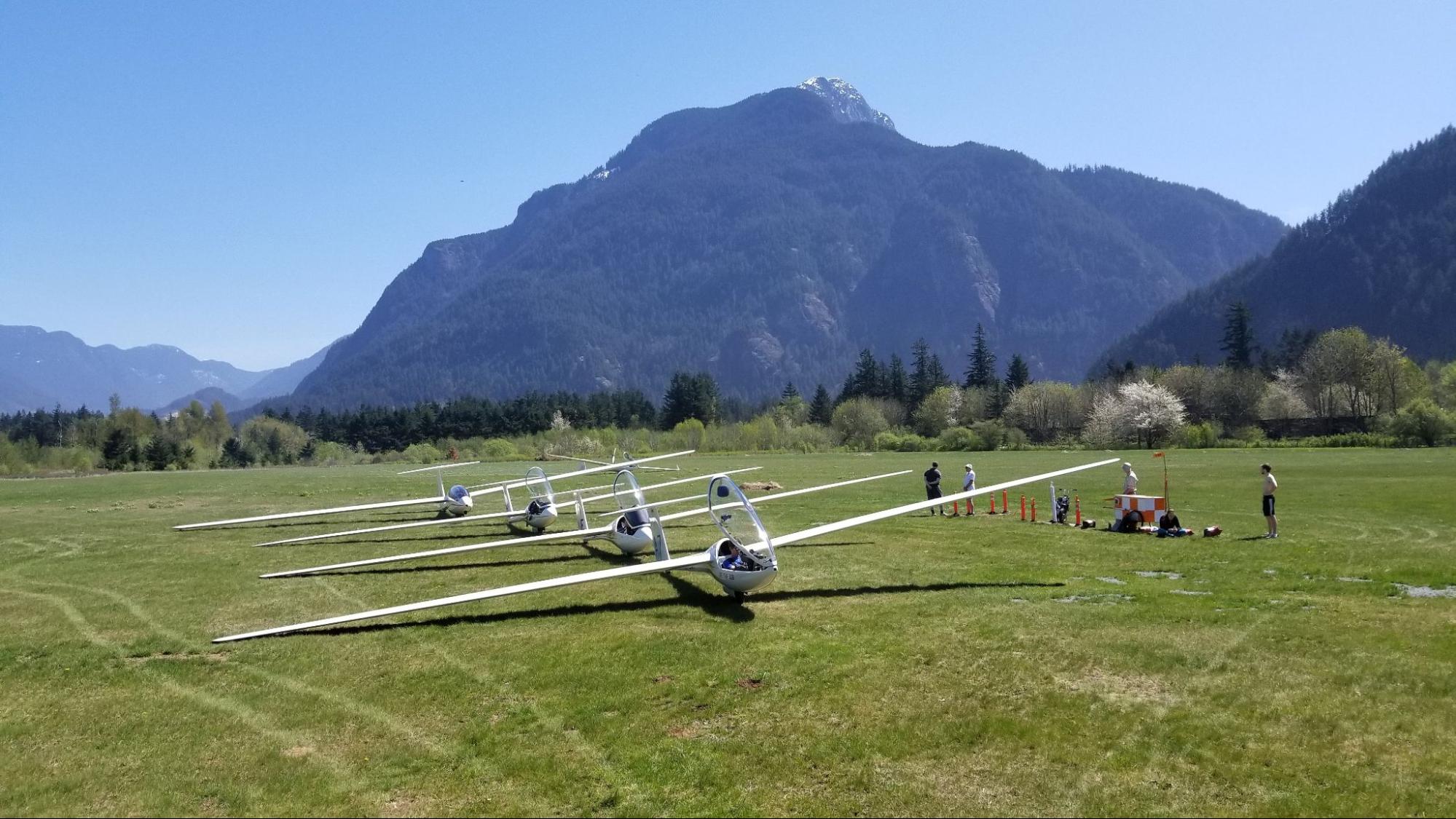
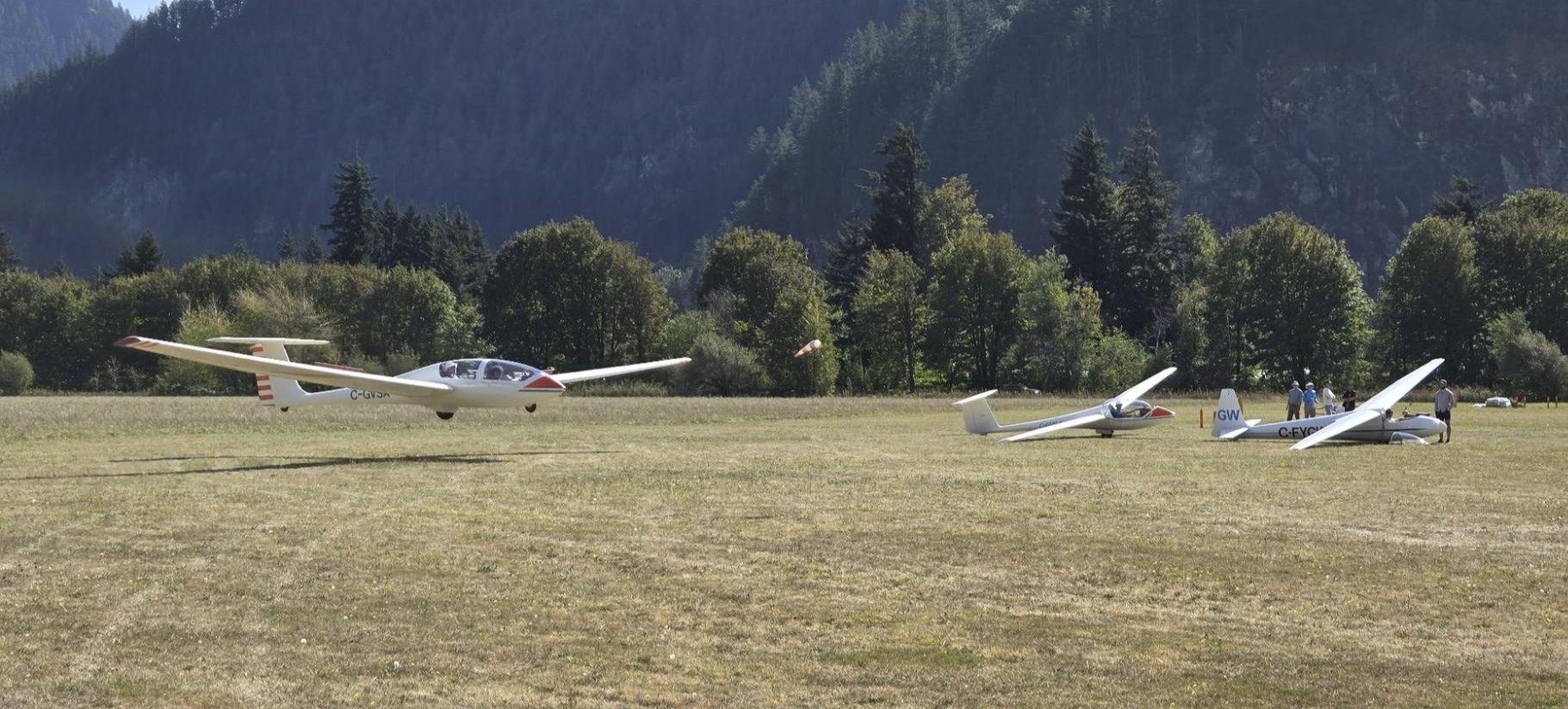
Flight line
We stage gliders by the runway threshold in preparation for take-off. People congregate here alongside our wheeled “ice cream cart”, staying clear of the power runway.
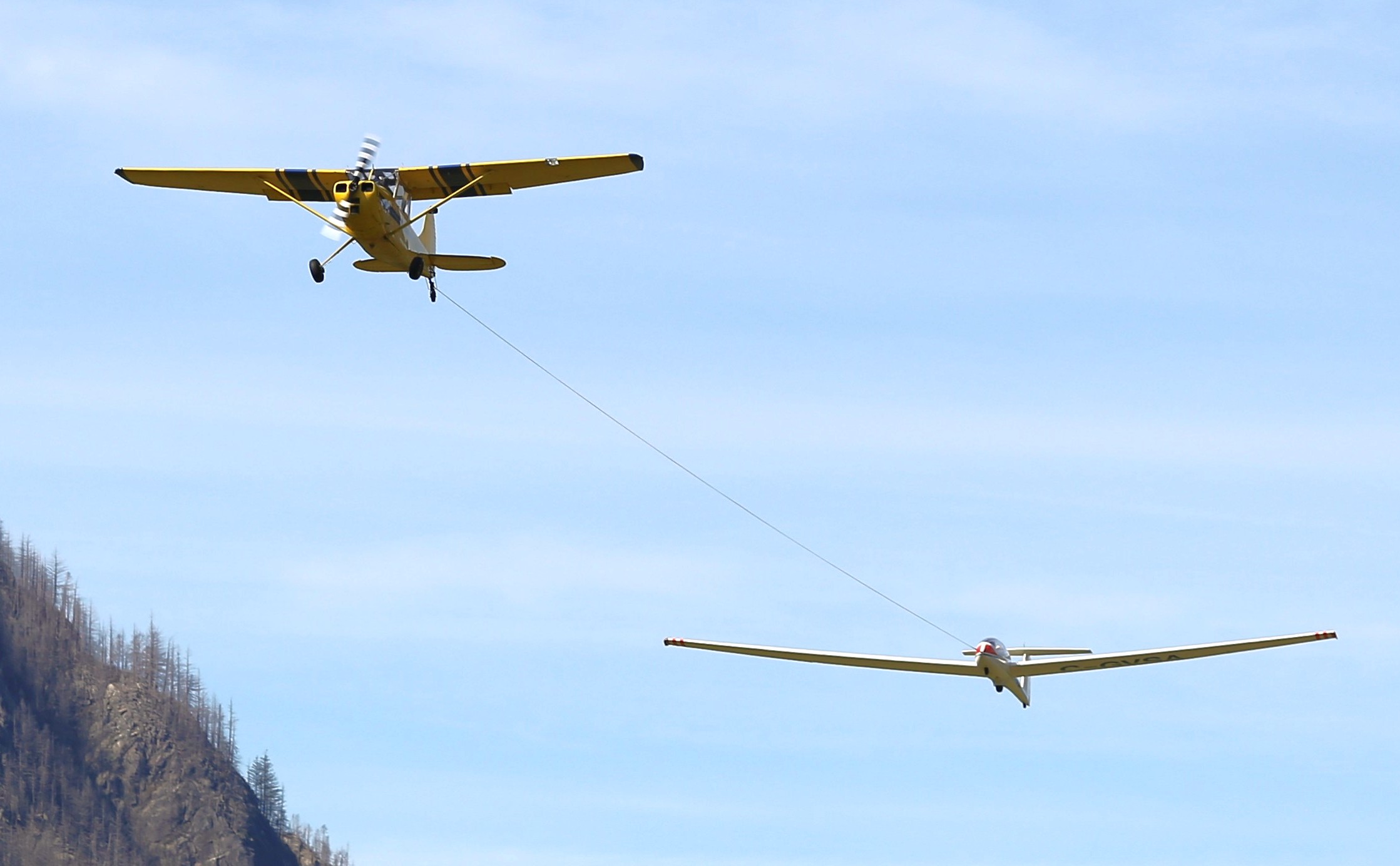
Take-off by aerotow
Our tow planes launch gliders by taking-off with a glider connected using a tow rope. The tow plane and glider fly in formation to the glider pilot’s desired release point. The glider then disconnects from the tow rope and continues in free flight while the tow plane returns to the airfield.
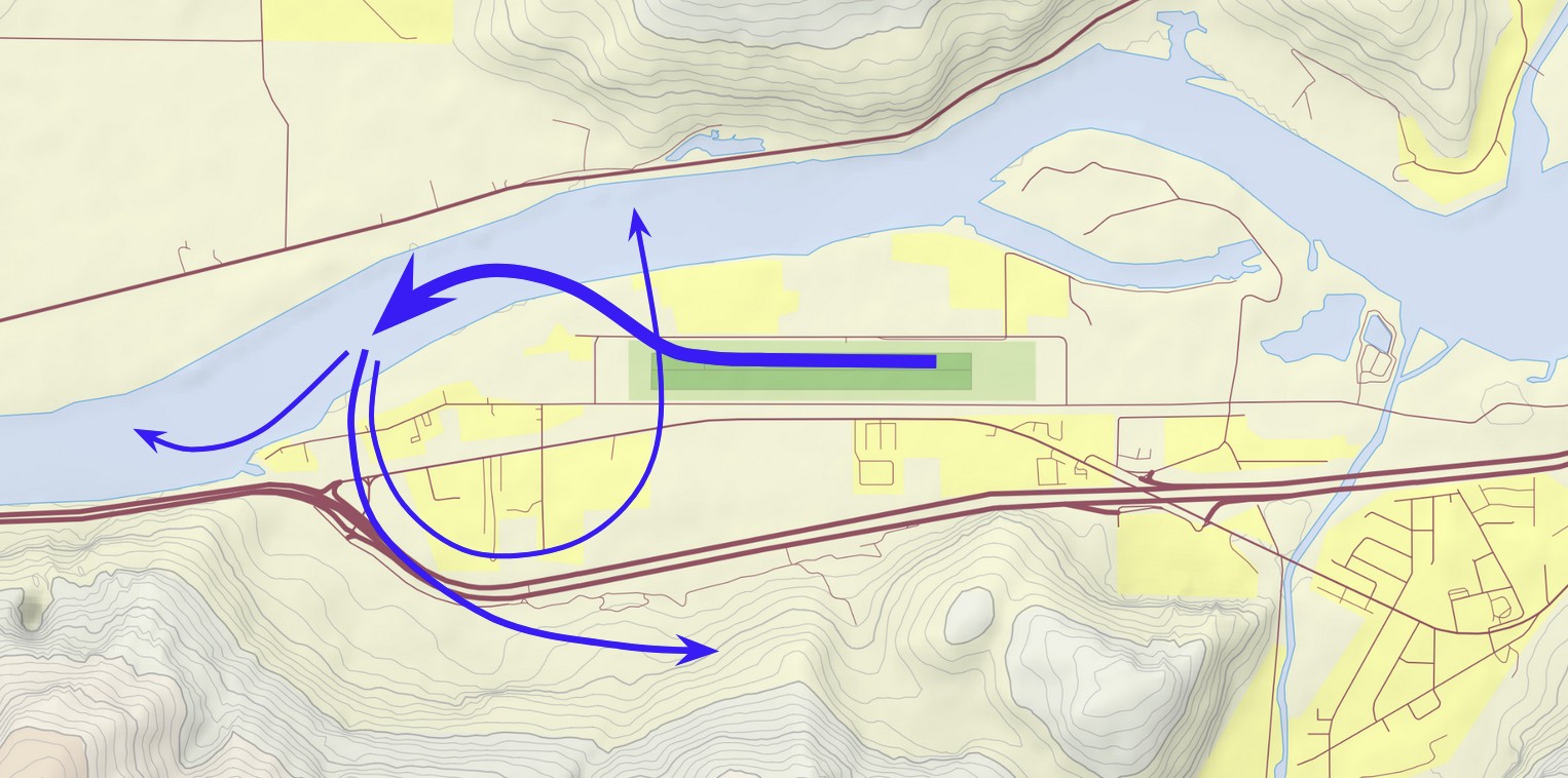
Non-standard departures
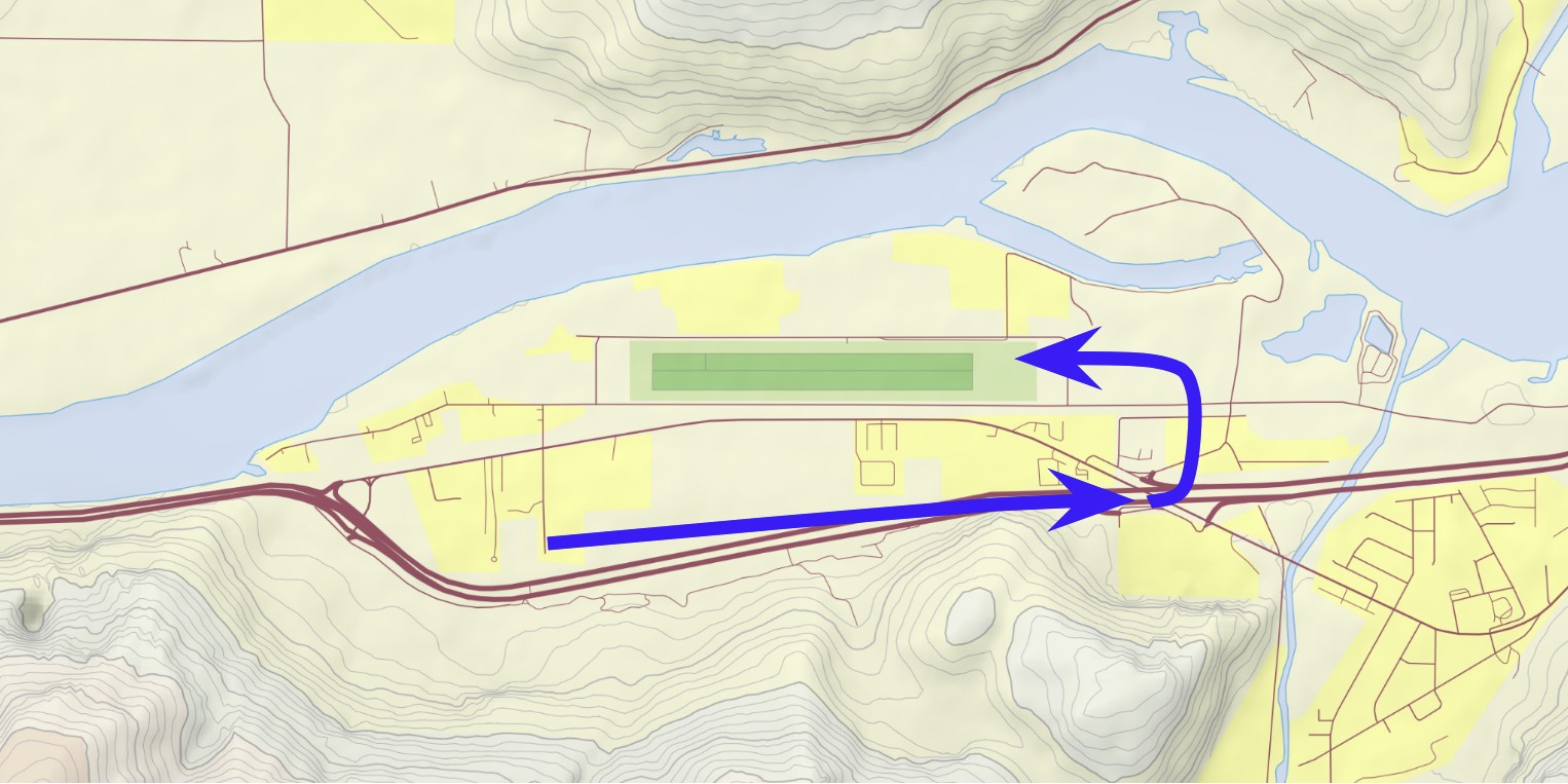
Aerotow departures from Runway 25R start with a slight right turn followed by a left turn over the Fraser River. Most aerotows continue close along the mountain ridge south of CYHE, but others may turn right from the Fraser River or continue turning left to cross over the airfield. Aerotow departures from Runway 07L may track right of centreline before turning left over the Fraser River.
Rarely straight and level
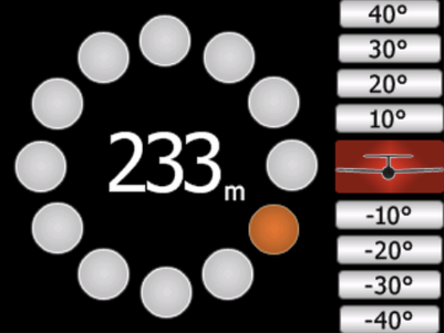
Gliders rarely hold a constant heading, altitude, or airspeed. We rely on updrafts, which glider pilots refer to as “lift”, in order to climb and sustain flight. Common forms of lift around Hope include wind blowing up mountains (“ridge lift”), warm rising air (“thermals”), and mountain / lee waves (“wave”). To remain in areas with the greatest climb rate, we fly in figure-eight patterns along ridges, circle with about 45° bank angle in thermals, and fly in figure-eight or racetrack patterns in wave.
Gliders descend in cruise between areas of lift, regularly making small course changes in response to subtle atmospheric cues to maximize performance. Pilots fly slow while in relatively favourable air, fly fast through unfavourable air (so-called “sink”), and may abruptly pull up from a fast cruise to enter a steep climbing turn upon encountering a thermal.
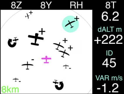
In gaggles
Glider pilots co-operate to find the best conditions and regularly fly in close proximity to each other. It’s not uncommon to find 3 or 4 gliders in the same area of lift with others coming and going. If you see one glider, then expect to find others nearby.
Low & tight circuits
Gliders enter downwind at 1,000 to 1,200 ft ASL about 2,000 ft alongside the runway and turn base about one-half mile from the runway threshold around 700 ft ASL. Downwinds for Runway 25 typically angle slightly towards the runway to keep clear of terrain.
Landings near the runway threshold
Gliders usually land close to the runway threshold north of the flight line, but may also land very long during training. Tow planes land on the power runway and then backtrack the glider runway to the flight line. Gliders occasionally land on the power runway and will usually try to roll clear off of the runway.
Emergency landing exercises
As part of flight training and proficiency checks, we practice simulated rope breaks during takeoff, where the glider may land straight-ahead, turn 180° and land downwind on either runway, or perform an abbreviated circuit. These exercises are most common during the spring. We avoid doing these exercises when there is traffic in the circuit.
Taxi by golf cart
We use a golf cart to taxi gliders. After landing, glider pilots may push their glider by hand to immediately clear the runway but this is not always possible.